EO Detective Resources for school or home learning
These resources were created using funding from UK Space Agency and NERC by Catherine Fitzsimons with support from ESA, ESERO UK, Rosie Leigh, Claire Burwell and other colleagues and teachers.
To download the resources, register for a free secure account with STEM Learning.
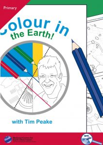
Colour in the Earth with Tim Peake
A booklet of line drawings created from a few of Tim Peake’s photographs of the Earth from space illustrate a wide range of human and natural features. Several of these are listed so children can create a key, effectively beginning the process of changing the photograph into a map. The teacher and home-learning guides give more information and describe an activity that also encourages students to think about what features might show in a photograph taken from space, what they might look like, what information it is useful to have on a map and how best to display it. The presentations include larger versions of the photographs, slides showing how they relate to the drawings, and ‘coloured-in’ drawings for classroom use.
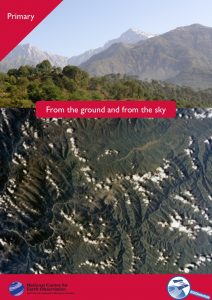
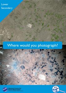
This activity introduces the idea of remote observation by asking students to match photographs taken from the ground with early astronaut photographs. It reinforces the use of geographical vocabulary to refer to physical and human features and extends the idea of recognising such features from aerial photographs.
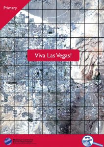
This main activity shows how earth observation can be used to study human geography. It asks students to measure the area of Las Vegas at three separate times over the last few decades, predict its current extent and then check their prediction. It can be used to teach, consolidate or review the measurement of irregular areas or/and addition and multiplication of fractions.
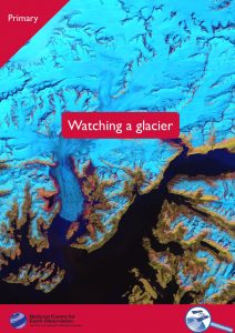
This activity shows how EO data is used to monitor environmental change and also asks students to measure irregular areas in a sequence of pictures: this time, bright false-colour composites created from satellite data.
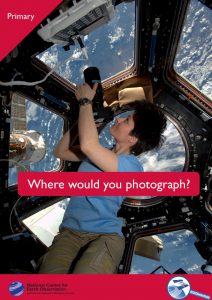
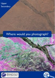
In this activity students take on the role of earth observation scientists submitting a request for an image they would like for their research. This gives them the opportunity to consider the possibilities of pictures taken from orbit (and the limitations) and to write scientifically for a specific audience. It can be used to consolidate learning from other EO Detective resources. give more information and describe an activity that also encourages students to think about what features might show in a photograph taken from space, what they might look like, what information it is useful to have on a map and how best to display it. The presentations include larger versions of the photographs, slides showing how they relate to the drawings, and ‘coloured-in’ drawings for classroom use.
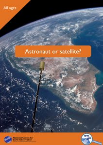
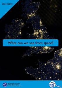
This activity introduces the idea of remote sensing and some of the difficulties of obtaining images from orbit by asking students to compare astronaut photographs, many of them from early missions, with satellite imagery.
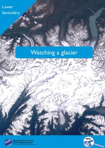
This brief activity uses false-colour images of the Columbia glacier to introduce the idea of using sequences of satellite images to monitor change and focuses on the selection of appropriate data for an investigation.
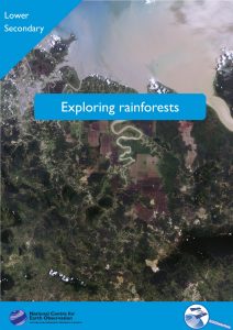
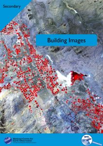
In this activity, students examine changes to forests in cross-border regions of Africa and Borneo using Google Earth to help identify features shown in satellite images and make measurements. The context allows students to explore the factors that put pressure on forested areas, and what is being done to protect them, as well as providing an opportunity to consider how incomplete data and subjective measurements can be used effectively.
In this activity students take on the role of earth observation scientists submitting a request for an image they would like for their research into changes in a particular landscape. This gives them the opportunity to consider the possibilities of pictures taken from orbit (and the limitations) and to write scientifically for a specific audience. It can be used to consolidate learning from other EO Detective resources.
This short activity introduces students to the ideas of the footprint and resolution of an image, asking them to choose and use appropriate methods to calculate how these quantities would change as they moved a camera to a series of vantage points above the surface of the Earth.
In this activity, students create colour images from satellite data. This allows them to study how different surfaces reflect different wavelengths of light, how coloured images are created using an RGB model, and how band combinations can be chosen to examine a particular landscape effectively.
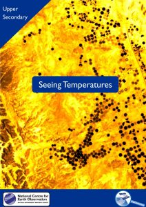
This activity allows students to investigate how images are produced from data streams by using first a spreadsheet and then a free image-processing program. They then go on to see how the usefulness of such a monochromatic image may be enhanced by using lookup tables and calibration. The materials used focus on the thermal infra-red allowing discussion of the electromagnetic spectrum and blackbody radiation.
In this activity students take on the role of earth observation scientists submitting a request for an image they would like to support their research into changes in a particular landscape using parts of the electromagnetic spectrum beyond the visible. This gives them the opportunity to consider the possibilities of pictures taken from orbit (and the limitations) and to write scientifically for a specific audience. It can be used to consolidate learning from other EO Detective resources.